
How to Build a District-Wise Knowledge Map of Uttarakhand for UKPCS
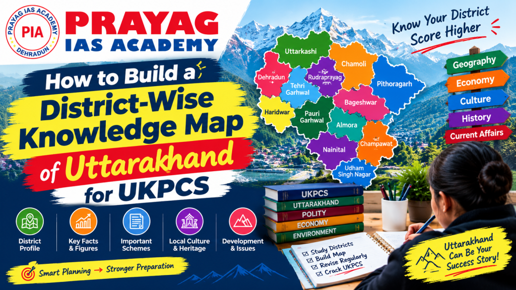
Preparing for the Uttarakhand Public Service Commission (UKPCS) examination requires more than memorizing facts and figures. A systematic approach to building a district-wise knowledge map of Uttarakhand is crucial for aspirants aiming to clear the preliminary and mains examinations with excellent scores.
The UKPCS examination, particularly the state service (PCS) and judiciary tracks, heavily emphasizes regional knowledge. Questions about Uttarakhand’s geography, history, administration, and socio-economic aspects form a significant portion of the question paper. At Prayag IAS Academy, we recommend our students develop a structured district-wise knowledge map as the foundation of their preparation strategy.
This comprehensive guide will walk you through creating a detailed district-wise knowledge map that covers all 13 districts of Uttarakhand, ensuring no important detail slips through the cracks during your UKPCS preparation journey.
Understanding Uttarakhand's Administrative Map: Divisions, Districts and Boundaries
Before building your district-wise knowledge map, you must understand Uttarakhand’s administrative structure. The state comprises two distinct regions:
Garhwal Region (7 districts):
- Chamoli
- Rudraprayag
- Uttarkashi
- Pauri Garhwal
- Almora
- Bageshwar
- Pithoragarh
Kumaon Region (6 districts):
- Nainital
- Udham Singh Nagar
- Haldwani
- Champawat
- Ranikhet
- Almora (shared boundary)
A proper district-wise knowledge map must clearly delineate these administrative boundaries, neighboring states (Himachal Pradesh, Tibet, Nepal, Uttar Pradesh), and inter-district borders.
Creating a District-Wise Geography Map of Uttarakhand
Your district-wise knowledge map should include detailed geographical information for each district:
Essential Geographic Data Points:
- District area and population density
- Geographical coordinates and altitude ranges
- Forest cover percentage (typically 64% across Uttarakhand)
- Major water bodies and their characteristics
- Soil types and geological formations
- Climate classification and rainfall patterns
For UKPCS aspirants, understanding how geography directly impacts human settlement, economic activities, and administrative decisions is vital. Each district has unique geographical features that determine its development trajectory. For instance, Uttarkashi district, being highly mountainous, has different infrastructure challenges compared to Udham Singh Nagar in the plains.
We recommend visiting the Uttarakhand Government Official Portal for verified geographical data and cross-referencing it with Census India resources for the most accurate information.
Mapping Major Rivers, Glaciers, Lakes and Mountain Ranges by District
A comprehensive district-wise knowledge map must include all significant water resources. This is crucial for UKPCS prelims and mains examinations.
Major Rivers by District:
| District | Primary Rivers | Secondary Rivers | Significance |
|---|---|---|---|
| Uttarkashi | Alaknanda | Yamuna, Bhagirathi | Major Himalayan rivers; irrigation & hydropower |
| Chamoli | Alaknanda | Dhauli Ganga, Nandakini | Sacred pilgrimage routes; tourism |
| Rudraprayag | Alaknanda | Mandakini, Pauri Ganga | Sangam (river confluence) zones |
| Nainital | Bhabar streams | Kosi River | Lakes region; tourism significance |
| Almora | Kosi River | Ramganga, Sarju | Agriculture dependent |
| Bageshwar | Saryu River | Gomti River | Border district; strategic importance |
Glaciers like Auli Glacier, Chorabari Glacier, and Trishul Glacier feed these rivers and are essential for understanding climate-related UKPCS questions.
Connecting Uttarakhand's Historical Sites, Dynasties and Heritage Locations
Every district in your district-wise knowledge map should include historical data:
- Pauri Garhwal: Former kingdom capitals, Gopeshwar temples
- Chamoli: Sacred pilgrimage sites (Badrinath, Auli temples)
- Almora: Capital during British rule; administrative headquarters
- Nainital: British hill station; administrative significance
- Pithoragarh: Ancient kingdoms; border strategy points
For detailed historical context, the Archaeological Survey of India (ASI) website provides verified information about historical monuments and heritage sites across each district.
Documenting District-Wise Folk Culture, Festivals, Languages and Traditions
Your district-wise knowledge map must capture the cultural diversity:
Cultural Elements to Document:
1. Languages: Garhwali, Kumaoni, Hindi, English (administrative)
2. Traditional Festivals:
- Garhwal: Uttarayan (kite festival), Kumaon: Bagowal (cattle festival)
- All districts: Raksha Bandhan variations, regional harvest festivals
- 3. Traditional Practices:
- Agricultural practices specific to each district
- Traditional water management systems
- Craft industries (wool, bamboo, pottery)
Understanding regional culture is essential because UKPCS questions often focus on cultural preservation, sustainable development, and community-based initiatives. Prayag IAS Academy’s Current Affairs section regularly covers cultural and heritage-related UKPCS topics.
Mapping National Parks, Wildlife Sanctuaries and Biodiversity Hotspots
Uttarakhand’s biodiversity is a consistent UKPCS topic:
Major Protected Areas District-Wise:
- Jim Corbett National Park: Nainital, Udham Singh Nagar (only tiger reserve in Uttarakhand)
- Rajaji National Park: Dehradun
- Kedarnath Wildlife Sanctuary: Rudraprayag
- Nanda Devi Biosphere Reserve: Chamoli, Bageshwar
- Valley of Flowers National Park: Chamoli (UNESCO World Heritage Site)
Your district-wise knowledge map should track:
- Flagship species (Bengal tigers, snow leopards, Himalayan musk deer)
- Endemic species unique to each district
- Conservation projects and challenges
- Eco-tourism potential and impact
Organising District-Level Agriculture, Industries, Minerals and Local Economies
Economic geography is crucial for UKPCS mains answer writing:
District Economic Profile Framework:
| District | Primary Agriculture | Key Industries | Mineral Resources |
|---|---|---|---|
| Nainital | Fruits, vegetables, tea | Tourism, food processing | Limestone, gypsum |
| Udham Singh Nagar | Rice, wheat, sugar cane | Sugar mills, distilleries | Phosphate, lime stone |
| Almora | Cultivated fruits, spices | Handicrafts, tea gardens | Copper, zinc ore |
| Uttarkashi | High-altitude crops | Hydropower projects | Hydropower potential |
| Pauri Garhwal | Horticulture, organic farming | Handicrafts, agro-based | Mineral springs |
Document livelihood patterns, skill development initiatives, MSME clusters, and government schemes specific to each district.
Linking Government Schemes, Development Projects and District Administration
Your district-wise knowledge map should integrate administrative information:
Administrative Details to Track:
- District magistrate and administrative divisions (tehsils, blocks)
- Implementation status of schemes like PM-KISAN, MNREGA, Swachh Bharat
- District development priorities and ongoing projects
- Educational institution clusters (colleges, universities)
- Healthcare infrastructure and vaccination drives
This information directly appears in UKPCS mains questions about governance, development indicators, and administrative efficiency.
Connecting Uttarakhand Current Affairs with Relevant Districts
Integrate current affairs into your district-wise knowledge map by:
- Linking recent government decisions to specific districts
- Tracking infrastructure projects (roads, railways, airports)
- Monitoring environmental issues (forest fires, floods, landslides)
- Following educational and healthcare initiatives
- Monitoring state and national policy implementations
Websites like PIB (Press Information Bureau) and Uttarakhand State Portal provide real-time updates on government schemes and projects affecting each district.
Turning the Knowledge Map into UKPCS Prelims MCQs and Mains Answer-Writing Practice
Converting your district-wise knowledge map into exam-oriented content:
Prelims Strategy:
- Create district-based MCQs (e.g., “Which district has the maximum forest cover?”)
- Practice location-based questions (administration, geography combinations)
- Take timed tests on district-specific knowledge
Mains Strategy:
- Write answers connecting historical events to current district development
- Practice answers on environmental challenges specific to districts
- Frame governance solutions using district-level case studies
At Prayag IAS Academy, we provide specialized answer writing practice with expert evaluation to help you master this critical UKPCS skill.
Revision Strategy: How to Update, Test and Retain Your District-Wise Knowledge Map
Maintaining your district-wise knowledge map requires:
Weekly Updates:
- Update current affairs linked to each district
- Add new government announcements and schemes
- Track changing administrative boundaries or new projects
Monthly Review:
- Revise one district completely with fresh focus
- Cross-check information with multiple sources
- Update statistical data
Testing Approach:
- Take district-based quick tests every week
- Write timed answers based on district-specific topics
- Join test series that emphasize regional knowledge
Memory Retention Techniques:
- Create visual mind maps for each district
- Use mnemonic devices for important facts
- Connect related information across districts (river systems, trade routes)
- Teach the content to peers for better understanding
Comparative Analysis: District-Wise Knowledge Map Methods
| Study Method | Advantages | Disadvantages | Best For |
|---|---|---|---|
| Manual District File | Personalized, detailed, comprehensive | Time-consuming to create and maintain | Serious UKPCS aspirants |
| Digital Database | Easy updates, searchable, portable | Requires discipline to maintain consistency | Tech-savvy students |
| Coaching Institute Materials | Expert-curated, exam-focused, structured | Generic, less personalized, costly | Beginners and busy professionals |
| Combination Approach | Balanced, thorough, adaptable | Requires coordination between sources | Maximum success rate |
Best Practices for Building Your District-Wise Knowledge Map
- Start Early: Begin building your map at least 6-8 months before the UKPCS exam
- Use Multiple Sources: Cross-reference government portals, academic materials, and news outlets
- Visual Organization: Use color-coding, symbols, and diagrams for better retention
- Link Connections: Connect geographical features to historical events, cultural practices, and economic activities
- Regular Updates: Keep your map current with latest government data and announcements
- Practice Integration: Regularly convert your knowledge map into practice questions and answers
Why Professional Guidance Matters
While building a district-wise knowledge map independently is possible, professional guidance significantly improves quality and saves time. Prayag IAS Academy offers specialized UKPCS preparation courses where expert faculty guide you through creating comprehensive district-wise knowledge frameworks, ensuring nothing important is missed.
Our structured approach helps students:
- Identify crucial topics often missed in self-preparation
- Understand the UKPCS question paper pattern better
- Develop answer-writing skills specific to state-level exams
- Access curated study materials aligned with the latest syllabus
Conclusion
Building a comprehensive district-wise knowledge map of Uttarakhand is not just a study technique—it’s a strategic investment in your UKPCS success. This approach ensures systematic coverage of the entire state, prevents gaps in knowledge, and provides a framework for integrating current affairs, historical context, and administrative information.
Start building your district-wise knowledge map today, maintain it diligently throughout your preparation, and watch it transform from a study document into your key to UKPCS success. Remember, success in UKPCS examination comes through systematic, organized, and persistent preparation—and a district-wise knowledge map is your blueprint for achieving that success.
Ready to accelerate your UKPCS preparation? Join Prayag IAS Academy’s personalized coaching program and benefit from expert mentorship, comprehensive study materials, and regular test series designed specifically for UKPCS aspirants. Our experienced faculty, including former civil servants, are committed to your success. Contact us today to learn more about our courses and request a free counseling session.
Frequently Asked Questions (FAQs)
1. What is a District-Wise Knowledge Map of Uttarakhand?
A District-Wise Knowledge Map of Uttarakhand organizes important information about each district, including geography, history, culture, economy, and major tourist attractions.
2. How many districts are there in Uttarakhand?
Uttarakhand has 13 districts, divided between the Garhwal and Kumaon regions.
3. How is a District-Wise Knowledge Map useful for UKPCS preparation?
It helps UKPCS aspirants revise district-specific facts, understand regional differences, and prepare for Uttarakhand-related questions in competitive examinations.
4. What topics should a Uttarakhand district-wise knowledge map cover?
It should cover district headquarters, rivers, mountains, national parks, historical places, festivals, local industries, important personalities, and cultural traditions.
5. How can I remember district-wise facts for the UKPCS exam?
Use maps, comparison tables, flashcards, regular quizzes, and revision notes to remember important facts and improve geographical understanding.
Request Free Counseling
Speak with our expert mentors today.

Civil Judge Eligibility After the Supreme Court’s August 2026 Ruling: Can Fresh Law Graduates Still Apply?
The Supreme Court’s 21 Aug 2026 ruling changed the practice rule for Civil Judge (Junior Division). Who can apply till 31 March 2027 and what changes after.

How to Choose Your UPSC Optional Subject Before the CSE 2027 Form Opens
Your UPSC optional is locked when you apply, and the CSE 2027 form runs 13 Jan to 2 Feb 2027. Official rules, all 48 options and a simple test to choose.

UPSC Prelims 2027: A 197-Day Plan From November to 23 May
UPSC Prelims 2027 is on 23 May 2027. A month-by-month plan from November, built on the official calendar and exam rules, with revision, mocks and CSAT.
Uttarakhand Foundation Day 2026: 26 Years of Statehood and the Facts Every UKPCS Aspirant Should Know
Uttarakhand turns 26 on 9 November 2026. Source-checked dates on its formation, renaming, capitals, seats and UCC, and how to revise them for UKPCS.
One Response